What magnetometry measures
Magnetometry measures variations in the magnetic field; gradiometry compares measurements at different positions to describe its gradient. The project includes total-field magnetometry and vertical gradiometry, using ground and UAV configurations.
Human-made structures, magnetically responsive materials and ground variations may produce anomalies. Signal shape is not a unique identification: archaeological and geological sources and modern interference must be considered together.
Ground, cart or UAV
Configurations already described in Services allow surveys to be planned around access and coverage. UAV surveying is not automatically better than ground surveying: sensor height, target distance, trajectory and noise affect the data.
Fences, vehicles, metal structures and other disturbance sources should be identified before acquisition. Configuration selection should explain what is observable under site conditions.
From signal to interpreted map
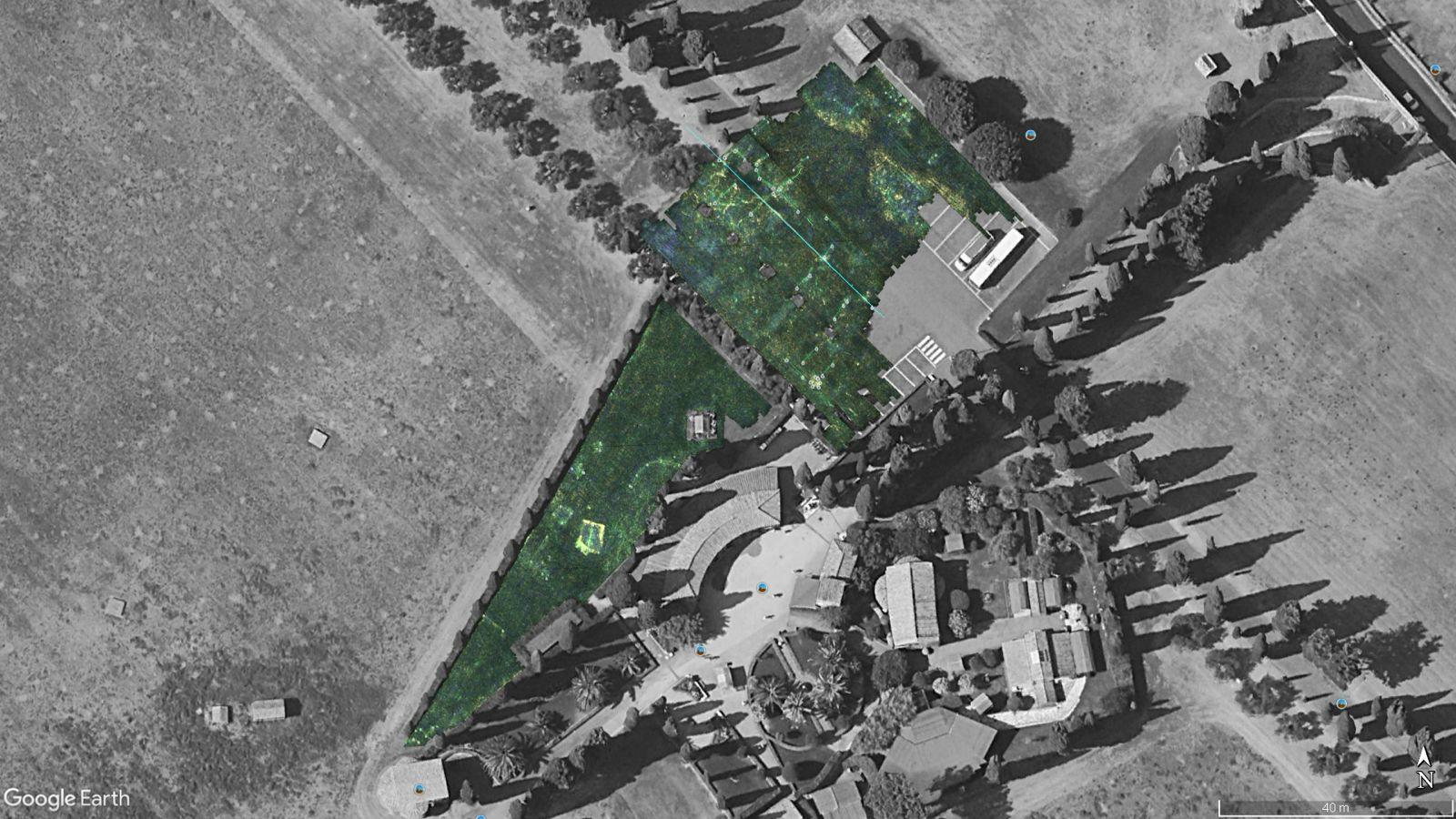
Georeferenced outputs relate anomalies to the project while separating measurements from interpretations. Existing project maps show magnetic responses over cartographic backgrounds; these are not definitive proof of target identity.
In an archaeological context, interpretation is shared with the appointed team and compared with GPR and other information where appropriate. Claims or procedures relating to UXO clearance are not transferred here: that is a separate domain.
When to integrate GPR
Magnetometry describes magnetic response, whereas GPR records reflected electromagnetic response. Combining them may help distinguish hypotheses or investigate selected areas; anomalies need not coincide.
The absence of a magnetic anomaly does not demonstrate the absence of archaeological features. Reporting needs to state limitations, disturbances and areas with insufficient data quality.
Related guides
Frequently asked questions
- Does magnetometry find every buried structure?
- No. Results depend on magnetic contrast, context and interference.
- Are UAV and ground surveys equivalent?
- No. Acquisition geometry, distance and noise differ. The choice needs to be justified against the objective.
- Does an anomaly identify the target?
- Not by itself. Interpretation and, when needed, complementary methods and archaeological verification are required.
What information does your project need?
Share the objective, site constraints and required deliverables so we can assess an appropriate survey strategy.
Submit your case